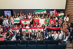
MEDSTAT IV holds training on Geographic Information Systems for Southern Mediterranean Statistics Institutes

Participants from National Institutes of Statistics of Southern Neighbourhood countries had the opportunity to learn, or to improve their knowledge, about the most used applications of Geographic Information Systems (GIS) for the production, dissemination, and analysis of statistical data, at a training workshop organised in Rome, Italy on 4-6 April 2017 by the EU-funded project MEDSTAT IV.
The workshop was also a unique opportunity for countries to share their experiences on the use of geo-information for statistics in their respective Institutes, and to be updated on the latest worldwide developments for the integration between geospatial and statistical data.
The training agenda included topics such as grid statistics and degree of urbanisation, online tools for the management and integration of geospatial and statistical data, mobile methods and techniques for statistical data collection, use of GIS in censuses and in statistical sample surveys, statistical geospatial frameworks, European geospatial standards, and role of geospatial data to support the definition and monitoring of SDG indicators for the implementation of the 2030 Agenda for Sustainable Development. Lessons and discussions were supported by presentations of case studies and by practical exercises carried out by the trainers directly with GIS software.
Read more
MEDSTAT IV website


 Syria
Syria 


